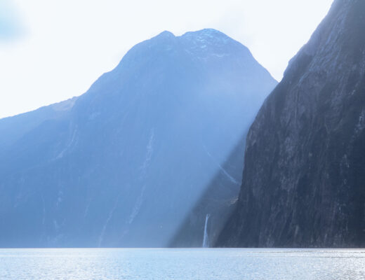
The Hooker Valley Track is a 10km (return) trail that leads through the dramatic Southern Alps and across rivers towards the glacial Hooker Lake at Mount Cook’s base.
This walk quickly became one of my favourite “short” walks on the South Island to date. It should without a doubt be in any travellers itinerary when visiting Aoraki Mount Cook National Park. The National Park is known for Mount Cook – the highest mountain in New Zealand. Its iconic peak has been the inspiration for many movie landscapes like The Hobbit: The Desolation of Smaug and is a recognised destination for hiking, sightseeing, and exploring.

The facts;
- 2-3hrs return
- 10km return
- Elevation gain; 124metres
- Medium fitness required
- Gradient; fairly flat
- Trailhead; Whitehorse Hill Campground
- There are public toilets located at the carpark/trailhead and halfway along the trail
- The track is designed to avoid this risk of avalanche, so stay on the path
Getting to Hooker Lake
After a time consuming drive from Wanaka and a little bit of lunch at the hostel, we headed straight towards Whitehorse Hill Campground to do the Hooker Lake Track before dark. I’d read that it was best to do the walk before the crowds in the early hours of the morning, but being mid-week and off-season, we barely saw anyone anyway.

I would recommend doing this walk in the early morning or late afternoon. Not only to avoid the crowds, but also the harsh sunlight. The walk is entirely exposed and the snow on the mountains add a harsher reflection down into the valley.
The trail from the carpark starts off as a long gravel trail before reaching the first suspension bridge of three. The Hooker Valley Track is known for its iconic swing bridges, and making your way across with a little gentle swaying really does add to the adventure. Beneath the bridge runs the hazy coloured river running from Mueller Lake. It’s minty colour coming from the rock particles of Mueller Glacier. Further along the track, the last two bridges cross over the Hooker River and its flowing rapids.
Note: the second swing bridge may be closed in high winds or in the case of a significant flood event.


The Track so far has been a flat gravel path, but once we pass the second bridge the vegetation changes to a much wider valley floor with open tussocks. This part of the walk was my favourite, the path winded it’s way towards the looming icy Mount Cook, and we stood within the valley surrounded by nothing but the neighbouring mountains.
Being so far away from civilisation meant that all that we could hear was the faint occasional bird and the rushing river rapids. After the third swing bridge it’s not much further until we reach the iceberg-speckled Hooker Lake. In late October I hadn’t ever imagined to see icebergs and glaciers – how wrong I was!


Hooker Lake
At the end of the track there were a few picnic tables and even a makeshift tripod for selfies. Some backpackers we crossed paths with chose this spot to crack open a couple of beers, but for us we were too busy walking down to the water to have a feel of how cold it was. At the far end of the lake you can see Hooker Glacier which remains frozen solid throughout the Summer months. Like most of the Southern Alps, this glacier has been melting fairly rapidly over the last few decades.

The return trip
The walk back follows the same route, so we made our way back at a pretty brisk pace.
What to bring;
- Hat & sunscreen
- Water & snacks
- Swimmers – if you feel like testing out the glacial waters!


No Comments